Top 5 Beginners’ Hiking Trails in Los Angeles
We’ve compiled a list of the 5 best hiking trails for beginners in Los Angeles that are perfect for a quick escape from the city. They are all in the Malibu area, making it possible to visit multiple hiking trails on this list on the same day. Each course is rated from beginner to moderate difficulty and is located within 50 miles of downtown Los Angeles and Orange County, making them easily accessible for residents in either area. These hiking trails are also under 2 miles, making them perfect for beginner hikers and families. You can check out all of our California Hiking Guides and Maps here.
1. Escondido Falls


Escondido Falls is located in Malibu, 35 miles west of downtown Los Angeles and 50 miles south of Orange County. This popular hiking trail follows a creek and leads to a 200-foot waterfall. The hike is easy to moderate, with a difficulty rating of 2. It’s only 0.75 miles to the lower falls and 1.5 miles to the upper falls. The roundtrip length of the trail is 3.8 miles, and it takes approximately 1.5-2 hours to complete. There is a parking lot at the trailhead, and it is pet-friendly. Restrooms are also available at the trailhead.
Getting to the Escondido Falls hiking trail is easy. Take the 101 Fwy North from Los Angeles, turn left at Las Virgenes, and then turn right on Pacific Coast Hwy (PCH) to get to Winding Way. You can also take Route 10 Fwy West – PCH – Winding Way. There is a parking lot at the junction of Winding Way about 4.5 miles west of Malibu Canyon Road, where Pepperdine University is located. Winding Way is private property, so curbside parking is prohibited.

We rate this trail with its picturesque waterfall and pool 4 stars. For more information on this hiking trail and directions on how to get there, check out our Escondido Falls hiking guide and map or visit the official website of the National Park Service.
2. Zuma Canyon


Zuma Canyon is located in Malibu, just 40 miles west of downtown Los Angeles and 50 miles south of Orange County. The trailhead is located at Zuma Canyon Road, just off Pacific Coast Highway. The trail is 1.8 miles roundtrip and takes around 1 hour to complete. Although this hiking trail is considered suitable for beginners, we still rate this hiking trail a level 3 difficulty. The course offers views of the Pacific Ocean and the Santa Monica Mountains. Parking is available at the trailhead, and the path is pet-friendly.
To get to Zuma Canyon, head north on State Highway 1 (PCH) for 20 miles from Santa Monica Beach. Just before you reach Zuma Beach, take Bonsall Dr on the right and continue all the way to the end of the unpaved parking lot. Once you arrive at the parking lot, you will find a signpost indicating the entrance to the canyon.

For more information on this hiking trail and directions on how to get there, check out our Zuma Canyon hiking guide and map or visit the official website of the National Park Service.
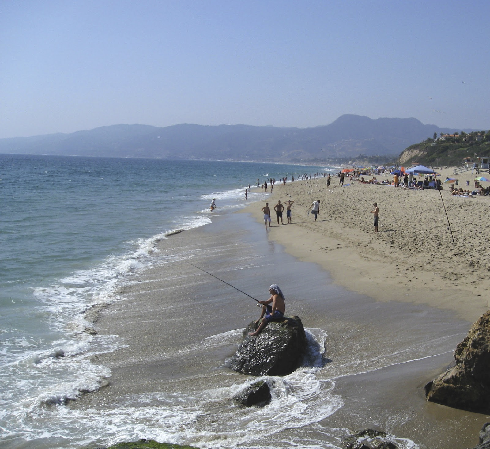
3. Point Dume Beach


Point Dume Beach is located in Malibu, just 35 miles west of downtown Los Angeles and 50 miles south of Orange County. The trail is only 1.5 miles roundtrip and takes 45 minutes to complete. The course offers stunning views of the Pacific Ocean and the Santa Monica Mountains. The trailhead is located near the parking lot at Point Dume Beach. The trail is relatively flat, perfect for beginners or families with children. The path is pet-friendly, and restrooms are available at the beach. It is one of the most accessible trails on this list, with a difficulty rating of 1. We also rate it 4 stars in our guide for its amazing beach views. What kind of Southern Californian doesn’t like a beach hike?
Getting to Point Dume is just as easy. From the end of Fwy 10 (Santa Monica Beach), follow State Highway 1 (PCH) northbound for 20 miles. Just before you reach Zuma Beach, take a left onto Westward Beach Road, leading you to the parking lot. From there, it’s just a short walk to the beach.

For more information on this hiking trail and directions on how to get there, check out our Point Dume Beach hiking guide and map or visit the official website of the City of Malibu.
4. Charmlee Wilderness Park

Charmlee Wilderness Park is located in Malibu, 40 miles west of downtown Los Angeles and 50 miles south of Orange County. The park has trails ranging from 0.25 to 3.5 miles, perfect for beginners or families with children. The highlights of these courses are their stunning views of the Pacific Ocean and Santa Monica Mountains. It is very accessible as it has a parking lot and restrooms available.
Charmlee Wilderness Park is just off the Pacific Coast Highway, and getting there is pretty straightforward. If you’re coming from LA, take the 101 Fwy North – Westlake (23 Hwy) Left – Encinal Canyon Road and 10 Fwy West – PCH – Encinal Canyon Road. Once you get to the entrance to the parking lot, pay the $3 parking fee in an envelope, and leave the receipt visible on the windshield.

We rate this hiking trail 4 stars. We consider this a great “bang for the buck” trail since you get a fantastic view of the California Coast for a pretty easy hike. For more information on this hiking trail and directions on how to get there, check out our Charmlee Wilderness Park hiking guide and map or visit the official website of the Santa Monica Mountains National Recreation Area.
5. Nicholas Flat


Nicholas Flat is located in Malibu, just 40 miles west of downtown Los Angeles and 50 miles south of Orange County. The trail is 1.8 miles roundtrip and takes around 1 hour to complete. The course offers stunning views of the Pacific Ocean and the Santa Monica Mountains. The trailhead is located at Leo Carrillo State Park, and parking is available there. The trail is pet-friendly, and restrooms are public at the park. Although suitable for beginners, we rate this hiking trail a level 3 difficulty. We give this hiking trail 4 stars for its spectacular Pacific coastline views.
To get to the Nicholas Flat Hiking Trail, take the 101 Freeway North from Los Angeles and turn left onto Westlake Blvd (23 Hwy). Follow Westlake Blvd until you reach Mulholland Hwy, then turn left. Drive about 10 miles until you reach Leo Carrillo State Park, where you must pay for parking and pick up a park map. The Nicholaswalkt Trail starts at the park entrance, so you won’t have to travel far to begin your hike.

For more information on this hiking trail and directions on how to get there, check out our Nicholas Flat hiking guide and map or visit the official website of the California State Parks.
Final Thoughts
Hiking is a great way to explore the outdoors and get some exercise, especially in Southern California. From waterfalls to ocean views, these trails offer stunning scenery without too much effort. The sunny California weather makes hiking these trails a perfect weekend activity almost every weekend of the year. Just remember to prepare for your hike and bring plenty of water and sunscreen. If you choose to bring your furry friend along for the hike, always make sure to check the park’s current regulations and keep them on a leash. We hope to see you out on the hiking trails!


