
Serrano Canyon Trail
Santa Monica Mountains
Distance: 8.5 miles
Duration: 5 hours
Elevation Gain: 1,100 feet
Difficulty: 3 (highest 5)
Season: September-May
Recommended Rating: 3 (out of 5)

Outline
- Introduction
- History
- How To Get There
- The Trail
- Tick Warning
- FAQ
- Links
Introduction
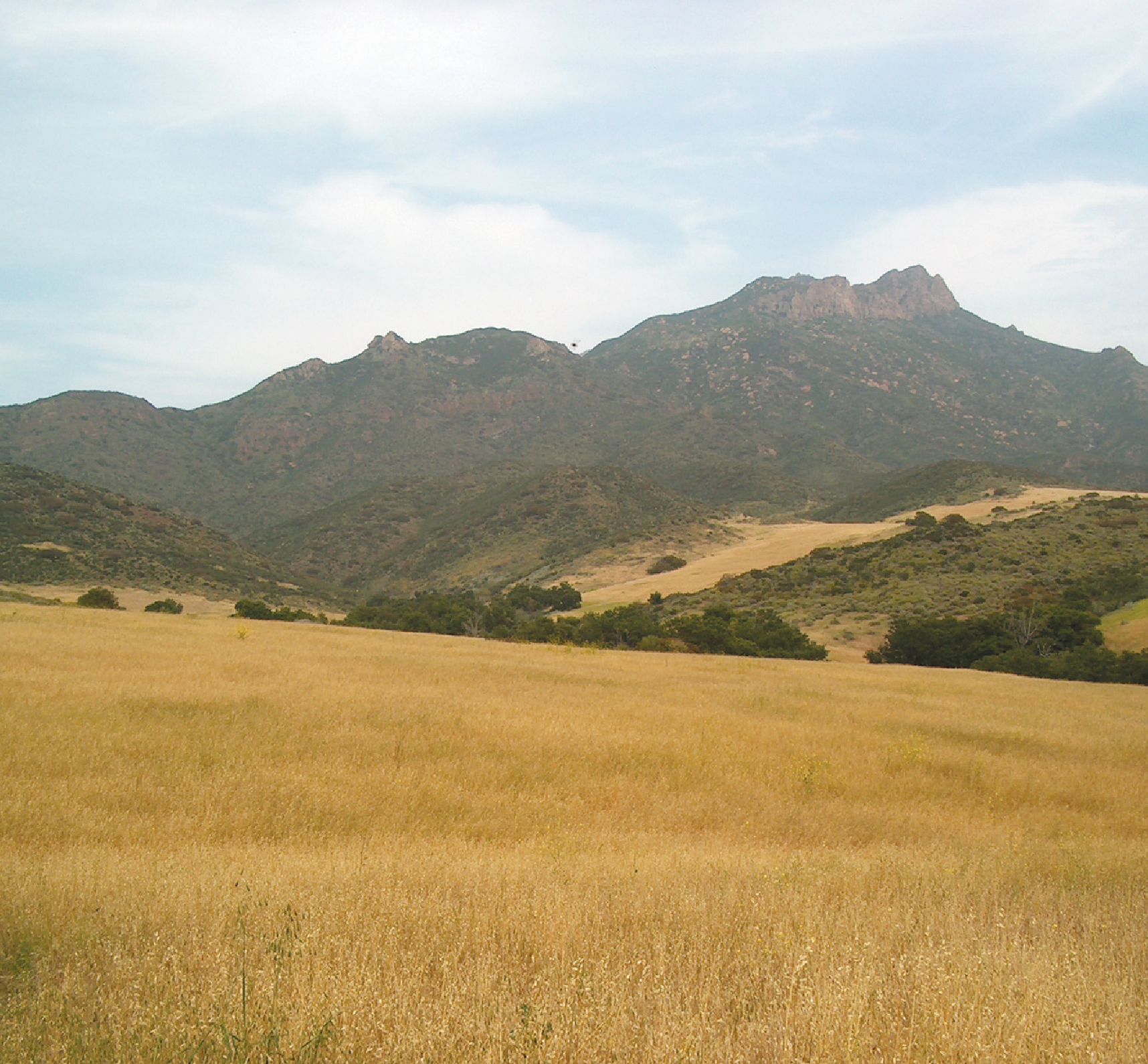
Are you looking for a hiking trail that takes you through a golden oasis in the Santa Monica Mountains? Look no further than the Serrano Canyon Trail in Point Mugu State Park, just an hour from downtown Los Angeles. This idyllic rural landscape is a hiker’s paradise, with waist-high golden barley fields and the majestic Boney Mountain.
History of Serrano Canyon
The area has a rich history, dating back to ancient times when the Chumash tribe lived in this valley. The area may have been used as a pasture through the pioneering era, as evidenced by a pump that was used long ago. It is still left in the middle of the meadow. In the early 1900s, climber Joseph Chase was fascinated by the new view of Bonnie Mountain and got lost while exploring it.
How To Serrano Canyon
To reach the trailhead, from the end of Fwy 10, drive about 30 miles along the Pacific Coast Highway (PCH) to the Sycamore Canyon entrance on the right. Park your car in the entrance parking lot, past the campground, and follow the unpaved Big Sycamore Canyon Road to the start of the trail.

The Trail
The trail begins with an impressive display of sycamore trees lining up on the left and right sides. Their leaves turn golden from early fall, and the trail is well-maintained, making for a pleasant hiking experience. At about mile 1.5, turn right into Serrano Canyon Road. The trail is filled with ferns, oaks, and sycamores growing along the creek.
After about mile 3.5, the trail opens to a vast meadow, and a narrow hiking trail continues between the barley fields on the left at the fork in the road. The path follows the ridge behind the meadow, surrounded by the peaks of the towering Boney Mountains, creating a beautiful folding screen effect. You’ll be treated to stunning views of Sycamore Canyon below, where the Backbone and Old Boney Trails meet.
Tick Warning
While hiking the Serrano Canyon Trail, it’s essential to watch out for ticks. These bugs look like bed bugs that live on tree branches and are known to carry Lyme disease. To protect yourself, wear long pants and long sleeves whenever possible.
FAQ
- How long is the Serrano Canyon Trail? The trail is approximately 7.5 miles round trip.
- What is the difficulty level of the trail? The trail is considered moderate, with some uphill sections and uneven terrain.
- Is there water available on the trail? No, bringing plenty of water is recommended, especially during hot weather.
- Are dogs allowed on the trail? Yes, dogs are allowed on the trail but must be kept on a leash.
- What is the best time to hike the trail? The best time to hike the trail is in the fall or spring when the temperatures are more relaxed, and the foliage is most beautiful.
Related Links
If you’re interested in exploring more about the Serrano Canyon Trail and Point Mugu State Park, be sure to check out these resources:
- Official website for Point Mugu State Park: https://www.parks.ca.gov/?page_id=630
- The National Park Service website for the Santa Monica Mountains: https://www.nps.gov/samo/index.htm


