
Vasquez Rocks
Santa Clarita
Distance: 3 miles
Duration: 1 hour 30 minutes
Elevation gain: 250 feet
Difficulty: 2/5
Season: October-April
Recommended rating: 3 out of 5

Introduction
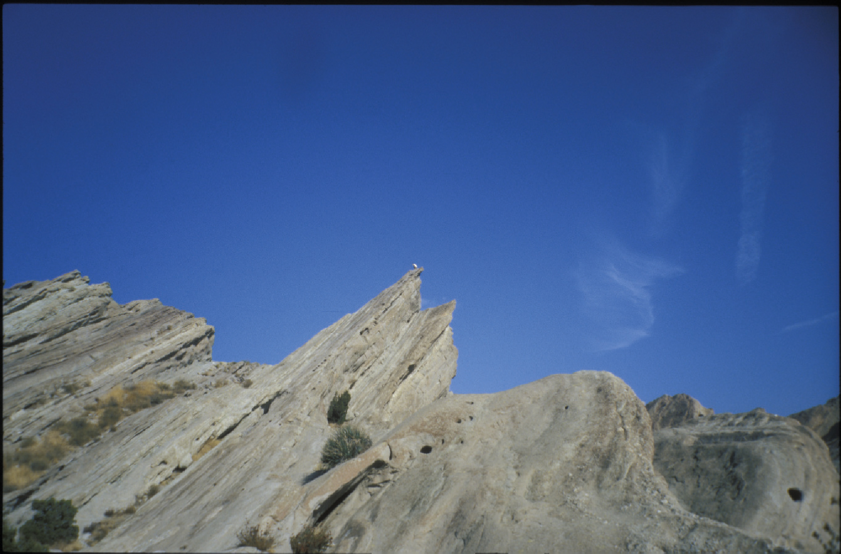
Located in the Agua Dulce Canyon, Vasquez Rocks County Park is a popular hiking destination near Santa Clarita, California. The park boasts unique rock formations that resemble sculptures and is also renowned for its geological significance. The park’s well-maintained trails make it an ideal location for hikers of all levels.
History of Vasquez Rocks
Vasquez Rocks County Park was a refuge for the infamous outlaw Tiburcio Vasquez and his gang in the mid-1800s. The area’s rough terrain and remote location allowed bandits to hide and evade the law.
Getting There and Trail Overview
The park can be reached by taking the 14 Fwy from LA towards Antelope Valley and turning left onto Agua Dulce Canyon Road. Once there, the park’s unpaved road leads hikers to various trails.
The Pacific Crest Trail (PCT) runs through the park, and hiking along it provides stunning panoramic views of the surrounding Escondido Canyon. The park’s center has a towering rock formation that dominates the skyline, and it is surrounded by an array of smaller rocks that attract visitors to explore the park’s various photogenic spots.
Recreational Activities
In addition to hiking, the park has many picnic areas that are perfect for families. Although shade may be scant, visiting in the cooler autumn and winter months will provide the most comfortable weather. Also, visitors may come across nature painters capturing the picturesque scenery or a group of students studying the geology of the rocks.
Conclusion
Overall, Vasquez Rocks County Park offers many hiking options accessible to hikers of all levels. Its unique geology, rich history, and scenic beauty make it an excellent outdoor activity destination.


