
Backbone Trail
Santa Monica
Distance: 12 miles
Elevation Gain: 1500 feet
Duration: 7 hours
Difficulty: 3 (highest 5)
Season: all year round
Recommended rating: 4 (out of 5)

Outline
- Introduction
- Getting to the Trailhead
- Hiking the Backbone Trail from Malibu Canyon Road to Corral Canyon Road
- FAQs
- Links & Resources
Introduction: The Backbone Trail – A Challenging and Scenic Hike
The Backbone Trail is an iconic hiking trail in the Santa Monica Mountains, spanning 67 miles from Will Rodgers Park in Los Angeles to La Jolla Canyon on the Ventura County border. This trail offers breathtaking mountains and ocean views and connects to many existing hiking trails. This article will focus on a 6-mile section from Malibu Canyon Road to Corral Canyon Road that is particularly scenic and challenging.
Getting to the Trailhead: Directions and Parking
To reach the starting point of the Backbone Trail, take the 101 Fwy northbound to Las Vergenes Road, turn left, and drive 3.5 miles off the freeway, past Malibu Creek State Park. Then, drive another 1.4 miles to Tapia Park. After passing Tapia Park (precisely 5 miles from the highway), a parking lot on the right side can park about 20 cars. Once you park your vehicle, enter the hiking trail through the road up the mountain with a sign saying Backbone Trail.

Hiking the Backbone Trail: A Scenic and Challenging Adventure
The hike begins with a gradual uphill climb that offers impressive views of the surrounding mountains. To the right, you can see the panoramic view of Malibu Creek State Park and the huddled houses dotted by the mountains. From about mile 2, you can see the Pacific Ocean, Santa Monica Beach, and Palos Verdes, which looks like a large island. The trail is well-maintained and easy to follow, with few obstacles.
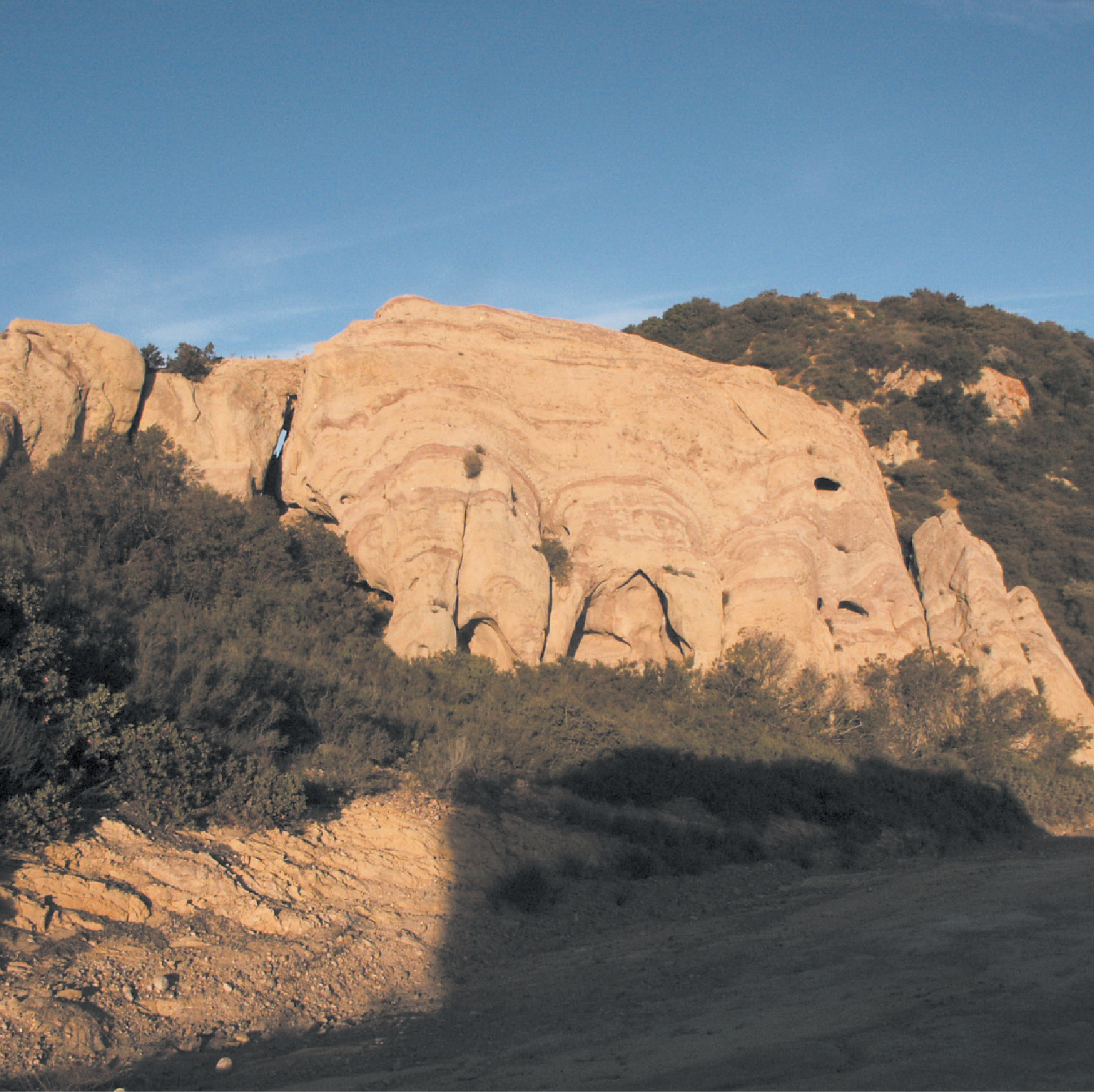
After about 2.5 miles, the path splits to Mesa Peak on the left, and the Backbone Trail continues to the right. If you go up about 3 miles further, you can see sandstone rocks protruding above the ground. These unique rock formations offer an incredible contrast to the surrounding greenery and blue sky. A bit further along, a parking lot connects to Coral Canyon. Above that, another section of the Backbone Trail goes down to Malibu Creek State Park.
As you hike, wear proper hiking shoes and bring plenty of water and snacks. The trail can be challenging at times, with steep climbs and descents. But the stunning mountains and ocean views are well worth the effort.
Conclusion: A Hike to Remember
Hiking the Backbone Trail from Malibu Canyon Road to Corral Canyon Road is an unforgettable experience that showcases the beauty of the Santa Monica Mountains. The trail may be challenging at times, but the stunning views of the surrounding mountains and the ocean make it well worth the effort
FAQ Section:
- Is the Backbone Trail difficult to hike? A: The Backbone Trail can sometimes be challenging, with steep climbs and descents. However, the trail is well-maintained and easy to follow, with few obstacles.
- Can I bring my dog on the Backbone Trail? A: Dogs are allowed on the Backbone Trail, but they must always be kept on a leash.
- Are there restrooms along the Backbone Trail? A: No restrooms are along the Backbone Trail, so use the restroom before hiking.
- Can I camp along the Backbone Trail? A: Camping is not allowed along the Backbone Trail. However, camping sites are nearby, such as Malibu Creek State Park.
- What should I bring on my hike? A: Wear proper hiking shoes and bring plenty of water and snacks. The trail can be challenging sometimes, so being prepared is essential.
Links and Resources:
- Backbone Trail – National Park Service
- Backbone Trail Map – Santa Monica Mountains Conservancy
- Malibu Creek State Park – California State Parks


