
Santa Ynez Falls
Santa Monica Mountains
Distance: 3 miles
Duration: 2 hours
Elevation Gain: 250 feet
Difficulty: 2 (highest 5)
Season: All Year Round
Recommended rating: 4 (out of 5)

Outline
- Introduction
- The Palisades Highlands Hiking Trail
- Hiking Along the Santa Ynez Trail
- Reaching the Waterfall
- Getting There
- Safety Tips
- FAQ Section
- Links and Resources
Introduction
The Santa Ynez Falls area is a popular hiking destination in Los Angeles. This article explores an alternate route of the area that starts in the Palisades Highlands neighborhood. In this guide, we’ll take you through the Palisades Highlands Hiking Trail to reach the stunning waterfall that awaits you.
The Palisades Highlands Hiking Trail
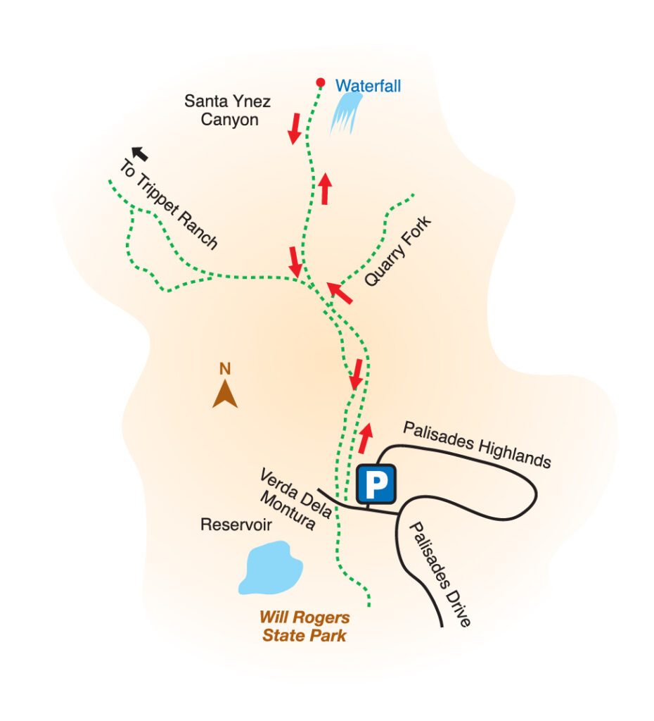
To start this hiking trail, you need to park your car on the Vereda Dela Montura road and enter the gate blocked by an iron fence. Once inside, follow the trail for about 0.5 miles, and when you see the signpost where the trail splits into two, turn right.
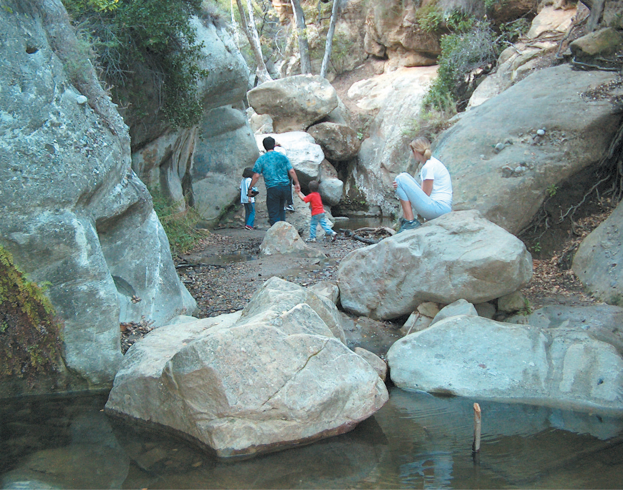
Hiking Along the Santa Ynez Trail
The Santa Ynez hiking trail has few slopes and is very lush, making it perfect for climbing with children. As you hike, you’ll notice the fresh grass and clear water flowing in the area. The trail leading to the waterfall is built along the stream. It is crucial to be careful, especially during heavy rain when the water can suddenly rise.
Reaching the Waterfall
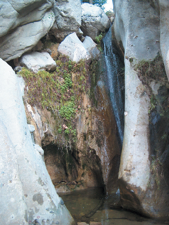
At the point where the road splits, if you jump across the stream a few times or go up the waterway, the trail’s width becomes narrow like a gorge. Eventually, you’ll arrive at the bottom of a waterfall with clear water. To get to the top of the waterfall, you need to grab a rope in the middle and climb over the rocks. This part of the hike is also enjoyable for young children. As you climb, the slope becomes narrower, giving you the feeling of entering a cave. You’ll also witness a waterfall flowing down one side of the rock, which is a sight to behold.
Getting There
Take the 10 Fwy heading west and exit onto Pacific Coast Highway (PCH). Turn right onto Sunset Blvd and then take a left onto Palisade Dr. Drive for approximately 2.5 miles until you reach Vereda De La Montura, then turn left and park your vehicle on the side of the road.
Safety Tips
Before heading out to the Palisades Highlands Hiking Trail, it’s essential to be prepared. Bring enough water and food, wear proper hiking gear and shoes, and let someone know where you’re going. Additionally, it’s essential to be mindful of the terrain and stay on the trail to avoid getting lost.
FAQ Section
- Can I hike this trail alone? A: Yes, you can hike this trail alone, but it’s always best to hike with someone.
- How long is the Palisades Highlands Hiking Trail? A: The trail is about 0.5 miles long.
- Is the trail well-marked? A: Yes, the trail is well-marked with signposts.
- What’s the best time of year to hike this trail? A: The best time to hike this trail is during the spring and fall when the weather is mild.
- Is there an entrance fee to the Palisades Highlands Hiking Trail? A: No, there’s no entrance fee to hike this trail.
Links
If you want to learn more about the Palisades Highlands Hiking Trail, you can visit the official websites of the National Park Service and the California State Parks. These sites provide valuable information about the hiking trail, including trail maps, safety guidelines, and park hours.
- National Park Service: https://www.nps.gov/samo/planyourvisit/santa-ynez-trail.htm
- California State Parks: https://www.parks.ca.gov/?page_id=629


