
Fish Bowls
Sespe Wilderness
Distance: 11.2 miles
Duration: 7 hours
Elevation Gain: 1,000 feet
Difficulty: 3 (highest 5)
Season: April-November
Rating: 3 out of 5

Outline
- Introduction
- Exploring the Cespe Wildlife Reserve
- Getting to Fish Bowls Trailhead
- The Fish Bowls Trail Starting Points
- Hiking the Fish Bowls Trail
- Tips for Hiking in Sespe Wilderness Reserve
- Conclusion
- FAQs
- Links
Introduction
If you’re looking for a place to hike near Los Angeles, California, the Sespe Wilderness Reserve may be just what you’re looking for. With its beautiful trails, stunning scenery, and a variety of outdoor activities, this wilderness reserve is a top destination for hikers and nature enthusiasts alike.
Exploring the Sespe Wildlife Reserve
One of the best hiking trails in the Sespe Wilderness Reserve is the Fish Bowls trail. This 11.2-mile trail takes about seven hours to complete and has an elevation gain of 1,000 feet. The trail is rated a difficulty level three out of five, making it suitable for intermediate hikers. The best time to hike this trail is from April to November.
Getting to Fish Bowls Trailhead
From Los Angeles, take Fwy 5 North for about 70 miles, past Gorman, and exit at Fraizer Park. Turn left and drive for approximately 7.5 miles before following Rockwood Valley Road on the left for another 10 miles. Turn left into Pine Springs (7N03) and drive eight miles to reach Fish Bowls Trailhead.

The Fish Bowls Trail Starting Points
The Fish Bowls Trail has three starting points. The official starting point is at the Fish Bowls Trailhead, where you can complete a 14-mile round trip to Fish Bowls. Another starting point is at the Cedar Creek Trailhead, about half a mile before Thorn Meadow Campground. The third option is to park cars on both sides of the Cedar Creek Trail and hike a loop around Fish Bowls Trail.
Hiking the Fish Bowls Trail
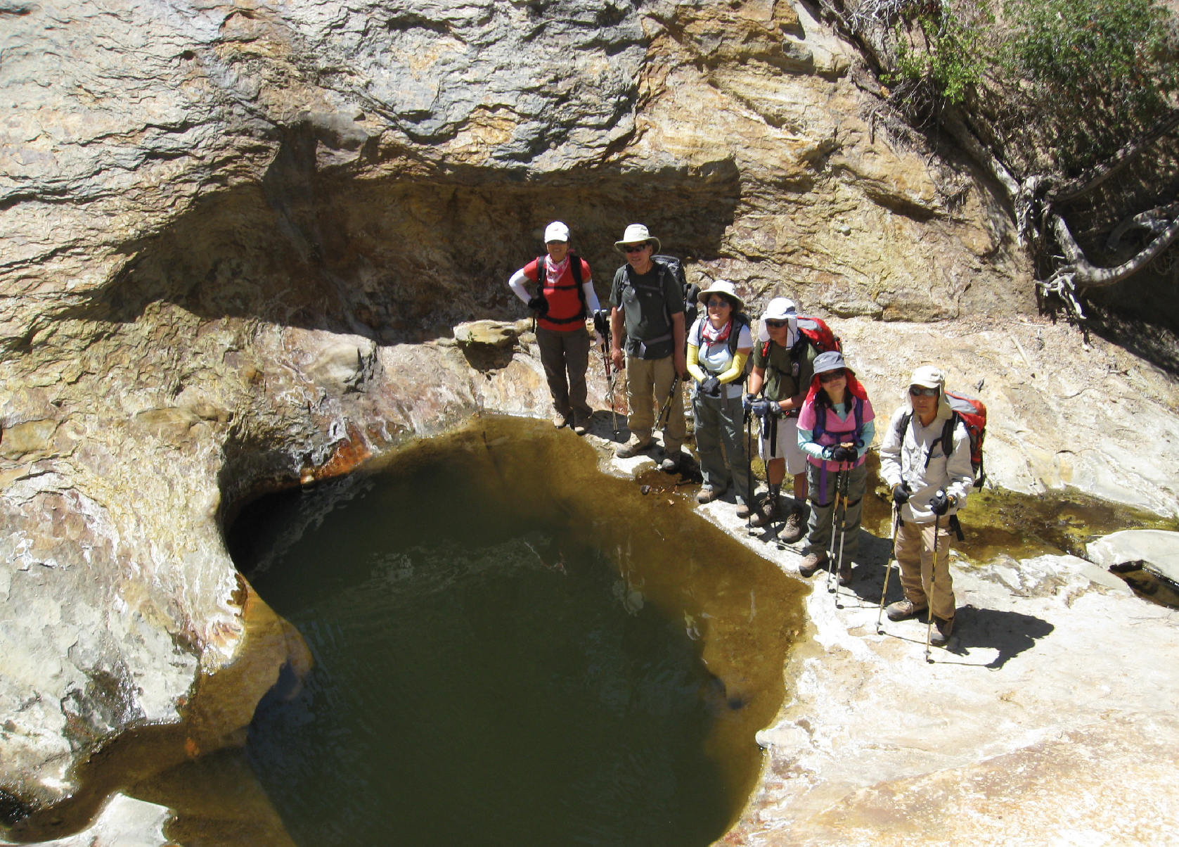
The first four miles of the trail are mostly flat, with water pockets resembling fish bowls found along the way. After about seven miles, hikers will reach Fish Bowls, which is a beautiful area with clear water and pine trees. From there, hikers can take the left fork and descend the mountain, passing Cedar Creek Campground before reaching Cedar Creek Trailhead.

Tips for Hiking in Sespe Wilderness Reserve
Before embarking on any hiking trails in the Sespe Wilderness Reserve, it’s important to check the trail conditions at the Pinos Ranger Station due to the area’s susceptibility to wildfires. It’s also recommended to bring Topo Maps as the trails are not always properly maintained. Lastly, don’t forget to stop by the Rockwood Valley Road Corner Pizzeria for a hot slice before heading home.
Conclusion
The Fish Bowls Trail in the Sespe Wilderness Reserve is a must-visit spot for anyone looking to explore California’s natural beauty. This 11.2-mile trail is perfect for hiking enthusiasts, and the breathtaking views of the mountains and waterways make it worth the effort. Whether you’re an experienced hiker or a beginner, the Fish Bowls Trail offers something for everyone. So, pack your bags and prepare to embark on an adventure of a lifetime!
FAQs
- What is the best time to hike the Fish Bowls Trail? A: The best time to hike the Fish Bowls Trail is from April to November, when the weather is mild, and the trail is open for hiking.
- Is the Fish Bowls Trail suitable for beginners? A: The Fish Bowls Trail is rated as a moderate hike with a difficulty level of 3 out of 5. While it is not recommended for complete beginners, hikers with some experience should be able to complete the trail with ease.
- Is there parking available at the Fish Bowls Trailhead? A: Yes, a parking lot is available at the Fish Bowls Trailhead. However, it is always advisable to arrive early to secure a spot.
- Is the Sespe Wilderness Reserve prone to wildfires? A: The Sespe Wilderness Reserve is vulnerable to wildfires due to its arid climate. It is highly recommended that hikers check the condition of the hiking trails at the Pinos Ranger Station before visiting.
Links
- Sespe Wilderness: https://www.fs.usda.gov/recarea/lpnf/recarea/?recid=81820
- Los Padres National Forest: https://www.fs.usda.gov/lpnf/
- Topo Maps: https://www.topozone.com/california/ventura-county/map/
- California State Parks: https://www.parks.ca.gov/?page_id=23595
- National Parks Service: https://www.nps.gov/subjects/hiking/index.htm


